- Home
- Categories
- Non Fiction
- Education and Reference
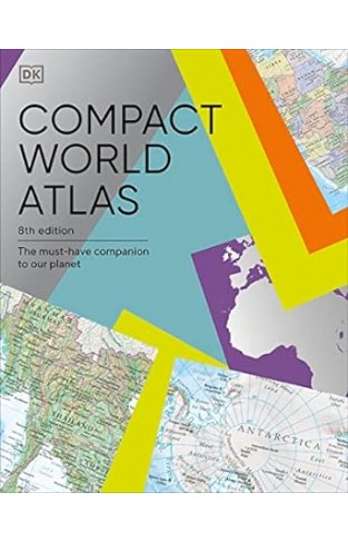
- Compact World Atlas 8th Edition - The Must-Have Companion to Our Planet
Compact World Atlas 8th Edition - The Must-Have Companion to Our Planet
By: DK
-
Rs 2,515.50
- Rs 2,795.00
- 10%
You save Rs 279.50.
Due to constant currency fluctuation, prices are subject to change with or without notice.
Arranged in two main sections - a world atlas and country factfile - the Pocket A-Z World Atlas provides an invaluable source of accurate, informative and interesting geographical information, all in one compact and affordable volume. The atlas section, arranged by continent, presents over 70 colourful, clearly labelled, easy-to-read regional maps showing all the world's nations, combining digital landscape modelling with the most important roads, railways, rivers, and settlements. Each map is annotated with fascinating 'insight' facts that reveal a wealth of amazing information from around the world.
The second section comprises a comprehensive series of country profiles, arranged alphabetically, covering all the essential facts and figures, including details of geography, climate, society, and economics. This section also contains reference factfile data for every nation, including the national flag, total area, population, languages, religions, and currency.
Dive straight in to discover:
- This new fully revised 8th Edition incorporating hundreds of updates to maps and statistics.
- 71 regional maps, 196 country profile maps, flags, and statistics.
- In-depth country profiles.
- Fully cross-referenced index/gazetteer.
Finding places is quick and convenient with a clearly-styled index of 7,000 atlas section place-names.
Ideal for family reference, crosswords, and quizzes, this atlas presents an intriguing and absorbing journey around the world in which we live.
The Sociology Book: Big Ideas Simply Explained Hardcover
By: DK
Rs 4,765.50 Rs 5,295.00 Ex Tax :Rs 4,765.50
Zubin Mehta: A Musical Journey (An Authorized Biography)
By: VOID - Bakhtiar K. Dadabhoy
Rs 892.50 Rs 1,050.00 Ex Tax :Rs 892.50
The World War I Book - Big Ideas Simply Explained
By: DK
Rs 4,495.50 Rs 4,995.00 Ex Tax :Rs 4,495.50
The Origins of Political Order From Prehuman Times to the French RevolutioN
By: Francis Fukuyama
Rs 4,045.50 Rs 4,495.00 Ex Tax :Rs 4,045.50
Manning Up: How the Rise of Women Has Turned Men into Boys
By: Kay Hymowitz
Rs 845.75 Rs 995.00 Ex Tax :Rs 845.75
The Obama Syndrome: Surrender At Home War Abroad
By: Tariq Ali
Rs 1,100.75 Rs 1,295.00 Ex Tax :Rs 1,100.75
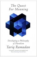
The Quest For Meaning: Developing A Philosophy Of Pluralism
By: Tariq Ramadan
Rs 1,185.75 Rs 1,395.00 Ex Tax :Rs 1,185.75
The World War I Book - Big Ideas Simply Explained
By: DK
Rs 4,495.50 Rs 4,995.00 Ex Tax :Rs 4,495.50
No recently viewed books available at the moment.
Zubin Mehta: A Musical Journey (An Authorized Biography)
By: VOID - Bakhtiar K. Dadabhoy
Rs 892.50 Rs 1,050.00 Ex Tax :Rs 892.50
The Sociology Book: Big Ideas Simply Explained Hardcover
By: DK
Rs 4,765.50 Rs 5,295.00 Ex Tax :Rs 4,765.50
The World War I Book - Big Ideas Simply Explained
By: DK
Rs 4,495.50 Rs 4,995.00 Ex Tax :Rs 4,495.50





-120x187.jpg?q6)








-120x187.jpg?q6)








-120x187.jpg?q6)

